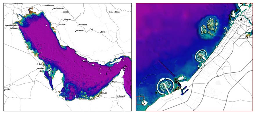
EOMAP's multi-source bathymetric grid for the Gulf region. A composite of most recent satellite-derived information, charts and survey data. (c) EOMAP, 2022
Map the gap with EOMAP!
Pioneering the field of satellite-derived bathymetry and aquatic Earth Observation, EOMAP supports both industry and governments. The international team has successfully completed hundreds of projects which improved the knowledge, surveying and management of coastal zones and aquatic environments.
About EOMAP:
Dilemma of bathymetry:
EOMAP’s Satellite-Derived Bathymetry solves the dilemma: It allows unique access to historic (30 years) and ongoing seabed changes, which generates dense bathymetric grids from shoreline down to depth of 25m (1x Secchi Disc Depth).

Smart monitoring, planning and decision making for projects in the coastal and nearshore regions requires spatial and temporal understanding of the environmental parameters. Man-made dredging activities, beach nourishments and erosion processes shape both shallow water bathymetry and coastline. Dubai’s coastal zone - like many others on Earth - is affected by these changes. Mapping and monitoring of the current situation and its development over time is a great challenge for conventional vessel-based survey methods: It would require significant efforts on equipment and costs - not to mention the complexity of surveying the very shallow waters by vessels. Satellite data analytics help to overcome this data and information gap and allow for a rapid assessment and improvement of the management on site.
EOMAP's multi-source bathymetric grid for the Gulf region. A composite of most recent satellite-derived information, charts and survey data. (c) EOMAP, 2022
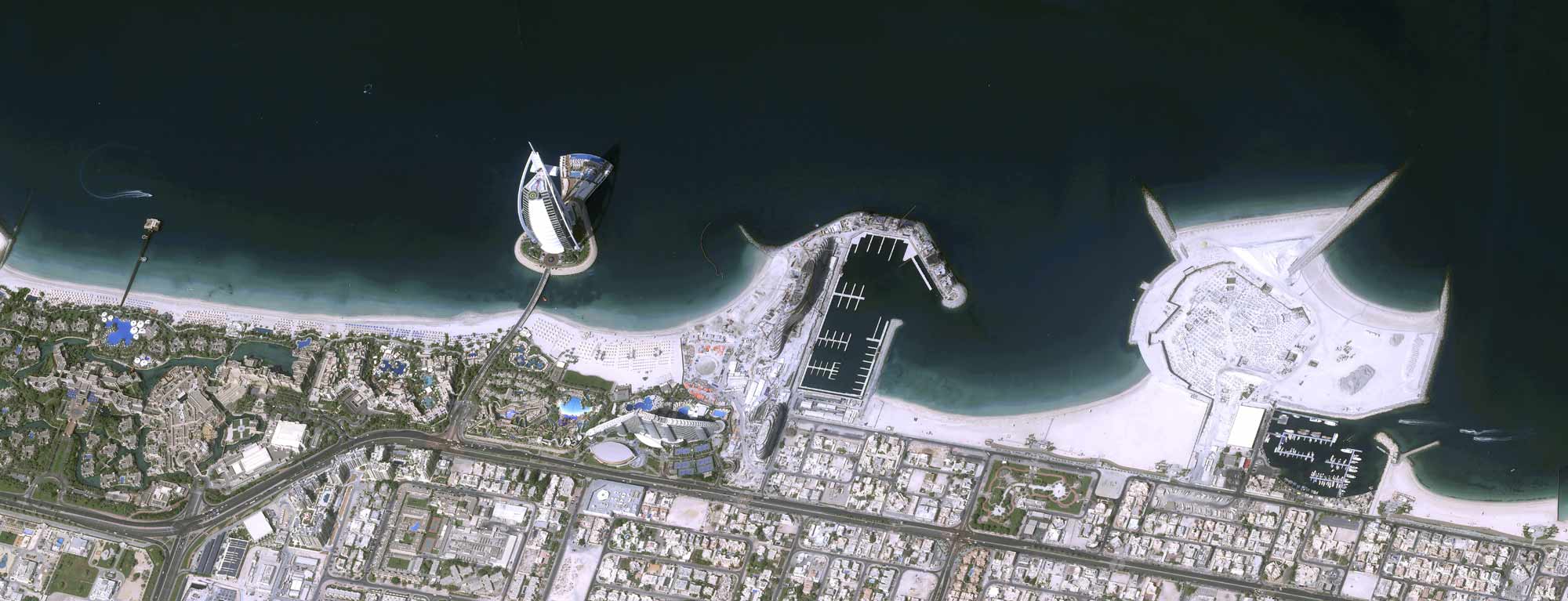
The beauty of satellite data becomes obvious once you check real-colour imagery of the very-high resolution satellite data of Pleiades Neo and others, spatial data in high level of detail.
But how to analyse satellite data without having local survey or calibration data?
EOMAP overcame this remote sensing challenge by developing precise models of the light interaction with atmosphere, water column properties and other environmental effects (inverse radiative transfer models).
In short: The EOMAP solution can provide reliable information on shallow waters in Dubai (as shown here) and for any other site in the world, without the need of on-site survey data.
Thanks to the Pléiades Neo constellation the spatial level of detail is excellent and bathymetric surface of 0.3m to 1.3m are possible. Furthermore, the capability to record coastal sites on demand allows for regular updates.
In collaboration with Airbus Defence and Space, EOMAP monitored shallow water dynamics and trends for Dubai.
The Very High Resolution bathymetric grids of the shallow waters for selected dates allowed the comparisons below:
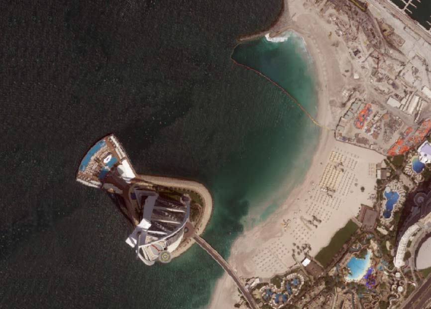
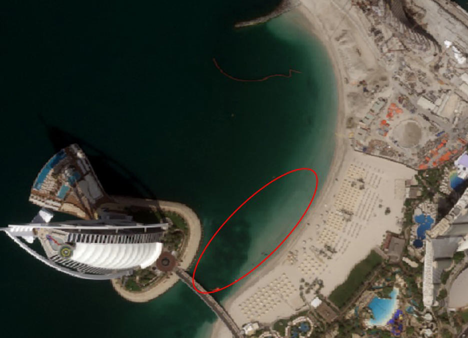
Real-colour Pléiades Neo satellite image recorded on 15th Aug 2021
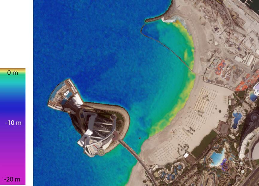
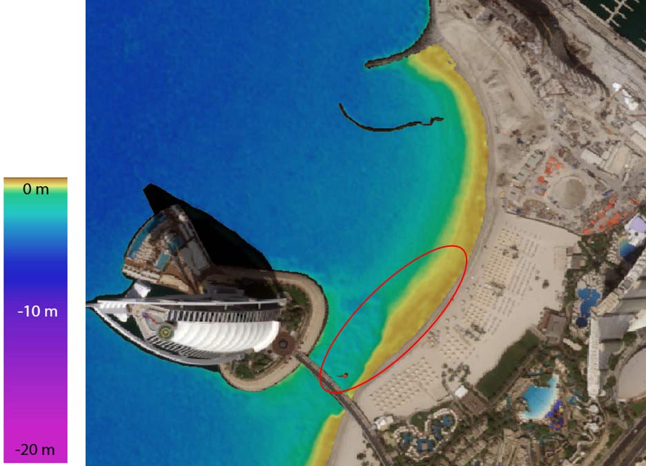
EOMAP's Satellite-Derived Bathymetry
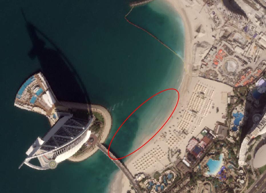
Real-colour Pléiades Neo satellite image recorded on 30th Sept 2021
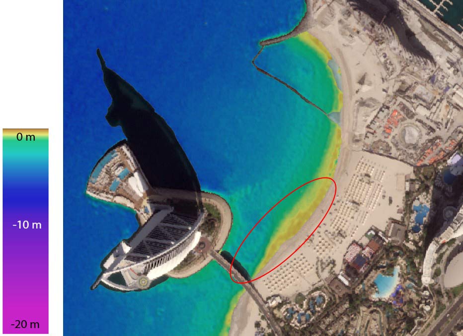
EOMAP's Satellite-Derived Bathymetry
Real-colour Pléiades Neo satellite image recorded on 11th Nov 2021
EOMAP's Satellite-Derived Bathymetry
From a time series analysis of VHR multispectral satellite data back to 30 years, EOMAP’s experts quantified the shoreline changes and erosion rates.
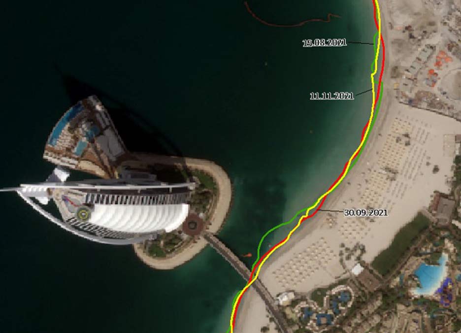
Shoreline change from Sept to Nov 2021 as observed
by Pléiades Neo satellite data analytics

Dr. Knut Hartmann
Chief Operating Officer - EOMAP

Karin Schenk
Head of Water Quality - EOMAP
EOMAP provides high quality satellite-derived data products and software services for a panoptic view on coastal and inland waters. Via a better understanding of this crucial environment, the international team wishes to contribute to a sustainable management. Founded in 2006, EOMAP has its headquarters near Munich, Germany and maintains offices in Australia, USA, Indonesia and in the United Arab Emirates.