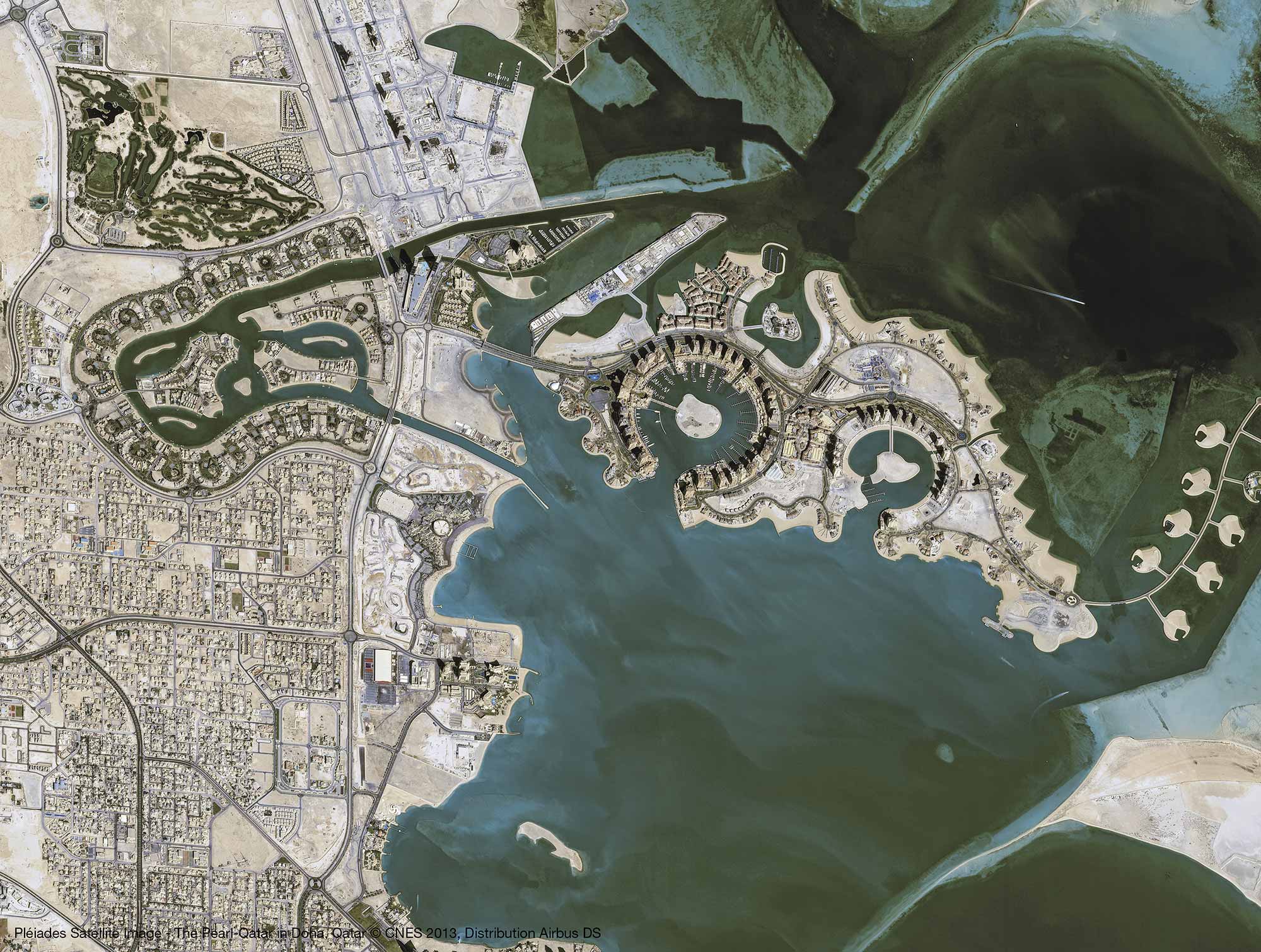
Our Radar satellites acquire datasets ranging from very high-resolution to widearea coverage. Data is acquired independent of weather conditions. After the successful launch of HisdeSAT’s X-band SAR satellite PAZ (a TerraSAR-X / TanDEM-X clone), the newly build Radar Constellation provides an increased acquisition capacity as well as an improved global mean revisit time (~ daily revisit) and a significantly reduced interferometric repeat cycle (4 days / 7 days), supporting data-hungry, high monitoring frequency applications. The Radar Constellation builds the reliable basis for a broad services & applications portfolio, benefitting from its accurate measurement, reliable monitoring and Near-Real-Time product capabilities.
TerraSAR-X / TanDEM-X
KEY FEATURES
- Imagery of varying modes with aflexible spatial resolution (from 25cm to 40m) and footprint
- Geometric accuracy unrivalled by any other commercial spaceborne sensor today
- Excellent radiometric accuracy
- Weather-independent site access to any point on Earth
- Unique agility (rapid switches between imaging modes and polarisations)
KEY BENEFITS
- Reliable, weather & daylight independent image acquisition & monitoring capability
- Capability to measure surface heights, surface movements
- Near-Real-Time (NRT) data & information delivery over large areas, for ship detection
- Large area coverage with unique resolution
- Best commercially available radar solution up to 25cm for IMINT applications
TASKING CAPABILITIES
- Two tasking plans per day for integration of short-notice requests in the tasking plan
- Virtual Ordering Station providing 24/7 online access to archive
- Online Interface as a web service to support secure ordering 24/7
- Personal tasking through Customer Care & Satellite Tasking Team
- Comprehensive network of ground stations and Direct Access Services
TARGETED MARKETS & APPLICATIONS
- Geospatial/Image Intelligence
- Digital Surface & Terrain Models (DSM & DTM)
- Maritime Monitoring
- Change Detection
- Environmental Mapping
- Surface Movement Monitoring
- Emergency Response Information