 |
| INTELLIGENCE June 2018 |
|
|
|
| Empowering Intelligent Decision-Making Airbus is the expert in intelligence integration, with decades of experience and references from key ministries across Europe and the globe. Our team of intelligence experts constantly develops and refines customer-centric systems to ensure customer challenges are answered with specific solutions. Airbus now offers geospatial intelligence centres: secure platforms that bring together multiple-intelligence sources, giving you the visibility to make informed decisions. The geospatial intelligence centre brings together imagery intelligence (IMINT), open source intelligence (OSINT) with geospatial intelligence (GEOINT), with the option to easily import and fuse other sources. |
||
|
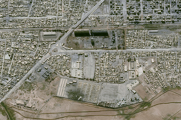
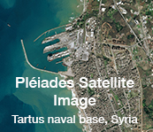
| Satellite Imagery Intelligence for Defence Operations When lives are at stake, defence and security-related decisions require accurate, actionable intelligence and a detailed understanding of the situation on the ground. Earth observation satellites have become an invaluable resource for defence and security missions, especially when planning operations and mission deployments remotely.
|
|||||
|
|||||||||||||||||||||
|
|
|||||||||||||||||||||
|
|
|||||||||||||||||||||
|
|||||||||||||||||||||
|
|||||||||||||||||||||
|
|||||||||||||||||||||
|
|
|
|
| Legal information |