INTELLIGENCE
December 2018
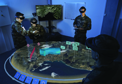
2018 Wrap-Up on Geospatial Activities in Intelligence
Director of Intelligence François Lombard extends his thanks to the 1,500 customers and partners all over the world who have placed their trust in Airbus to get precise and reliable imagery, geospatial products and solutions. He underlines some of the key achievements around the Digital Platform OneAtlas and the forthcoming launch of innovative new sensors to even better serve our customers. Stay tuned for a wrap-up on our cutting-edge Multi-Intelligence and C4ISR solutions! 

Watch the video 
Understanding the Impacts of Climate Change
Earth’s climate is changing faster than at any point in the history of modern civilization. Airbus explores its imagery archive to unveil 12 sites already affected or facing future climate challenges.
 Explore more 
Introducing the Holographic
Tactical Sandbox
With the ‘Holographic Tactical Sandbox’ commanding and staff officers are now able to conduct mission briefs or rehearsals with an interactive 3D holographic map for an improved perception of the battlefield and remote tactical planning.
Read more  
Airbus and John Deere Receive Silver Medal of SIMA Innovation Award 2019
The new service Live NBalance, is merging satellite and tractor data in order to monitor intra-field nitrogen balance even more precisely during the growing season.
Read more  
Webinar: Make the Most Out of Satellite Imagery for Your Agricultural Services
Whether you are a precision agriculture leader or a start-up in precision farming services, this webinar is for you! Discover more about Verde, Airbus’ brand new API delivering incomparable crop analytics.
Register here  
Our Products in Action
Providing African Cities with Safe Access to Drinkable Water Using Elevation1

320 million people in Africa do not have access to drinkable water. To prevent epidemics linked to hydric diseases, the International Committee of the Red Cross (ICRC) is engaged in providing safe access to drinkable water. To evaluate the risk of mudflows and to position the pipes Airbus Defence and Space provided ICRC with its Pléiades-based Elevation1 Digital Terrain Model (DTM), ideal for hydrological applications.
Read more  
YOUR FREE
SAMPLE DATA
Sample data
DID YOU KNOW?
MapTiler wins Airbus challenge of the Copernicus Masters 2018. As an alternative to Google Maps MapTiler API powered by open data, provides ads-free personalised maps, protecting the privacy of users and running both online and offline.
WEBINAR RECORDING
In our webinar “Speed Dating with Airbus: Find your Perfect Match”, we provided a snapshot of Airbus data options that can suit a variety of applications. Watch the webinar recording here.
Our Latest Images
Contact Us
Buy Our Imagery
www.intelligence-airbusds.com
Legal information